Saturday, 2 August 2014

Trekking in Lake Garda: a From Bardolino; Percorso San Rocco


Lake Garda is a vast lake approximately 30 minutes from Verona in Northern Italy. It's southern end, with the medieval bustling town of Sirmione, is wide and almost sea like while the northern half narrows between the imposing alps of the Southern Dolomites. The windy northen tip is popular with sail boarders and water sports fanatics while the southern half us surrounded by vineyards and olive groves, producing optimal produce. The soaring Monte Baldo, accessed by a rotating cable car from Malcesine, provides plenty for he keen hiker but the hills and valleys around Bardolino and Garda also provide wonderful and diverse scenery.

The Percorso San Rocco is signposted as route "M" and can be completed on foot within about 3.5 hours or by mountain bike in around 2 hours. It departs at the northern end of Bardolino from via San Colombano. Initially an asphalt road leads to a dirt track that soon transports you between olive groves and vineyards of the many local producers including Feudo, Vignol and Cortelline. The views back towards the lakeshore of Bardolino beyond the fruitful vineyards and olive groves is also complimented by the undulating hills and mountains that encircle the town. There are many twists and turns along the pathway but the signage is generally excellent. You will see other signs for routes that entwine  but you will stay on course if following the M signs throughout. From vineyards and olive groves to rocky moutain paths, this route proved sa surprising and pleasant diversity of terrain. After a couple of hours you head uphill towards Eramo dei Camaldesoni and the walled Hermitage of the Camaldese monks where monks reside in huts on the hillside. Here you can visit the church and they have a store selling their produce like honey and oil.

From here the path circles the mountainside and provides sweeping views over the valleys and townships inland. The path swings around to reveal an M sign pointing to the left and a sign indicating Path A up to Rocca Vecchia. Take the path up to Rocca Vecchia. It's a bit rocky and a little steep but the panoramic views over Bardolino and Garda are the highlight of the entire walk. 

To return to Bardolino, return to the signpost before Rocca Vecchia and continue downhill until you reach a fork indicating 2 pathway options. Take the path yo the right. This slowly descends within about an hour to the lakeside of Bardolino.

Path Map

Sign posts to follow

Views from the path through the vineyards


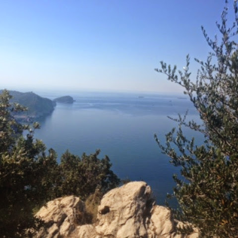
View from Rocca Vecchia over Bardolino

View over Garda


Friday, 11 July 2014

Tiziano's Pathways

Tiziano's Profile

Name: Tiziano Davini
Lives: Lammari (Lucca)
Background: Tiziano is 36 years and a qualified Telecommunications Engineer but his passion has always been mountain biking and trekking in the fresh open air of the mountains especially around his region of Tuscany. He is a passionate photographer with his own photography website displaying beautiful landscapes and panoramas from his many hiking and cycling excursions. 
Visit: www.tizianophoto.com 

Tiziano escorted me on a magnificent journey amongst the abundant spring daffodils to Monte Croce, a 5 hour unforgettable journey. Here are his favourite hikes and cycle routes. 


Favourite trekking Path

Monte Prado (Appennino) Highest Tuscany Peak
Departure and arrival point: Passo Forbici
Ascent: 650 m;  5/6 hours
Difficulty: medium
Pathway is signposted by CAI as 00 & 633 (Sentiero CAI: 00, 633)
Description and points of interest:  This route is confined between Tuscany and Emilia Romagna. The first section follows sentiero di crinale 00 with many marvellous views over Garfagnana, the Alpi Apuane and the Tuscan Emiliano Appennine. After about 2 hours you reach Monte Prado, having the highest Tuscan peak with an elevation of 2054m. From here you descend to Lake Bargetana, Lama Lite and the magical forest of Abetina Reale before rising again to Passo Forbici. The course passes two refuges, Rifugio Battisti and Rifugio Segheria.


Favourite Mountainbike Path 

Val Fegana
Departure and arrival point: Tereglio
Ascent: 1200 m 
Distance: 30 km
Difficulty: medium
Pathway is signposted by CAI: 38, 9
Description and points of interest: Departing from the beautiful borgo of Tereglio you ascend 500m in the Val Fegana, a valley beside the Serchio river. You follow along the road and then left parellel to the valley for 4km after which you descend on a single track in the nature reserve of the Orrido di abortive. This is a canyon that can also be visited on foot with a € 2 entrance fee. From Ponte a Gaio you ascend on via Principale up to Rifugio Casentini within 6 km. Continuing to Rifugio Casentini  (1280 m) there is food and fresh spring water from the fountain. After the Rifugio the pathway becomes stone and rises 7km to Foce al Giovo along via del Duca. This is an ancient road connecting Modena with Lucca. Foce a Giovo is 1674 m altitude with a beautiful panorama including Monte Rondinaio and the whole Taglione valley. After enjoying the gorgeous view you descend on the same road that you arrived on until you reach Ospedaletto where you turn right into sentiero 38. This is a beautiful and peaceful pathway. There are some difficult and exposed areas so care is needed whilst still enjoying the beautiful scenery over Val Fegana. After 4km the path reaches Rifugiani on a stony path. We follow right, uphill for 200m then take Sentiero 9 to the left that, initially, rises to Focedi Cavallaia and then descends to Tereglio along a beautiful mule path. 


Contacts:

Telephone. 3396522920
E-mail: davinitiziano@gmail.com

Tiziano will be thrilled to accompany and guide tourists and passionate hikers or mountain cyclists along these and many other pathways that suit your needs and level of capability finding Rifuges and hotels in the mountains to complete your stay. 


Sunday, 6 July 2014

Hiking in Portofino National Park: Santa Margherita to Camogli


Portofino, world renowned for its beauty, is thought by many to be the jewel of Liguria. A tiny village in a colourful cove, its waters are a popular resting place for luxurious yachts and flashy cruisers. The village is a colourful cluster of buildings set in front of luxuriously green mountains. These mountains and the waters from Santa Margherita to Camogli, form the Portofino National Park. Within its mountains and valleys are a network of hiking paths reaching to the summits and around the cliffs and valleys. With a wide variety of options to choose from, two wonderful half day hikes are:
1/ Santa Margherita to Camogli; and 2/ Portofino to San Fruttuoso


1/ Santa Margherita to Camogli

Santa Margherita is a much larger tourist town, bustling with motorbikes along the coastal road and full of lively markets, restaurants, food stores and fashion shops. It's colourful, frescoed buildings almost look like stage props and its port is jam-packed with boats of every size. Artisan food stores including pamificios are piled with traditional focaccia freshly baked with locally produced olive oil and sprinkled with salt, rosemary, pesto, tomato and other toppings. Fruity jam- filled tarts, pandolce, and various other pastries make mouths water and beckon you in to try this exquisite cuisine. Meats, cheeses, fish, fruits and vegetables grown or caught locally, are in plentiful supply. Santa Margherita is fresh food paradise. Heading passed these wonderful stores without being too distracted is a challenge but the start of this walk is at the end of the car free, shop lined main centre, left of the municipal building. Heading up via Costasecca, the sign indicating the hike can be seen close to the corner.  The first half of the walk is sign posted in a symbol of 2 red diamonds. This is a different system of signage to the typical CAI sentieri of Italy as these paths are managed by the Portofino National Park. The red symbols appear throughout the walk on multiple surfaces such as rocks, tree trunks, gateways, and the sides of houses. Regular green and white signs indicating the various pathway options appear at almost every junction. 


As predicted, the path becomes steep almost immediately. You only need to glance at these towns in the Gulf if a Paradise to realise that they are set in front of a steep, mountainous backdrop of luxurious forest. The paved path soon transforms into irregular stairs, heading steeply upwards past colourful luxurious homes with beautiful views. Soon, the path takes you through olive groves and terraced fruit and vegetable plantations. Views over Rapallo and Santa Margheita can be enjoyed as you rise.


 It's a very strenuous climb so be prepared. My chest is heaving and the humid air makes my singlet cling and sweat pore down my face. The path is soon a combination of rock, stone and dirt as it heads ever upwards. There are regular signs pointing you toward Pietra Strette, the summit of the mountain overlooking Santa Margherita and Paraggi (the gorgeous beach side village between a Santa Margherita and Portofino). Continuing up you soon enter a forested area of ferns and chestnut trees. As you climb higher, pine forest dominates. The hike upwards lasts about 40-60 minutes but I stop regulaly to capture photos of the breath taking views. 


Upon reaching Pietra Strette there is a cleared area with picnic tables and some large rock formations forming a canyon that you pass through. Now the path changes direction and heads toward Toca soon you are traversing the mountainside but still relatively sheltered by forest. As you reach the coastline views across the sea suddenly surprise you. This part of the coast is dominated by rocky sheer cliffs plummiting into the sea to create a more rugged beauty. The ocean is a turquoise blue, very striking against the pale grey cliffs and the dark green of the forest. The occasional boat can be spotted, taking tourists from Portofino to San Fruttuoso. Beautiful wild flowers in yellows, purples, oranges and whites line the edges of the path. Yellow butterflies and bright green lizards flutter and scurry. 


Soon the path passes high above San Fruttuoso affording glimpses of the monestry and village through gaps in trees. The path remains a mix of rock and dry soil but is well maintained with excellent signage. An optional diversion recommended (only 5 minutes each way) Semiforo Nuovo to enjoy the beautiful view of the coastline and out to San Rocco. 


The descent down to Camogli is surprisingly long. The path exits forested parkland and enters the outskirts of a village known as San Rocco di Camogli. This is a small, sweet, hill top village with a tiny piazza and church. As I walk through the village, local residents greet me with warmth and the tiny piazza is full of people of all ages, relaxing, chatting, enjoying each others' company. As I pass the church the descent into Camogli begins. This  consists of over 900 stairs but the decent is not steep and the stairs are irregular, often requiring an extra step in between, making the journey more knee-friendly.

 The colourful town of Camogli is displayed below. The village itself is steep. A main pedestrian street leads from the station to the port and to the left are many stairways leading down to the waterfront. The seafront is again a cluster of colourfully painted buildings but not with the same feel of luxury that Portofino and Santa Margherita have. This is a simpler, more humble and much quieter fishing village. The beach areas are small and characterised by large dark grey stones. The port at the town's edge is small but full of fishing boats. Camogli has several options for gelato and food, but most stores will be closed between 1-4pm. To return back to Santa Marghrita, the most efficient and easiest option is the train.


Saturday, 21 June 2014

Ligurian Food

Liguria is a narrow, long region hugging the coast from the French border. It's eastern tip touches Tuscany while Piedmont pushes it close to the sea. Its warm climate, calm seas and lush mountains make the cuisine a wonderful collaboration between food sourced from both land and sea. Some of the most unique flavours and gastronomic delights include:

Trofie with pesto
Pesto is a traditional food of Liguria and is made with the freshest of locally grown basil, pine nuts and olive oil with the addition of a touch of garlic and finely grated Parmesan cheese. The warm climate and fertile soil provides ongoing supply of fresh basil. Pine nuts are grown locally in the wild growing pine trees in the mountains above the coast. These ingredients are ground together with locally produced olive oil added. 
Trofie (pronounced "troff-ee-eh) is a thin pasta that has been curled around a fine stick and cut short. This pasta is the perfect vehicle for carrying the thick pesto sauce. A small serving in a bowl with fresh basil is the typical Ligurian mode of eating this first course for either lunch or dinner.

Fariniata
Farinata is a thin flat "bread" that is made by mixing chickpea flour (chickpeas are locally grown), water and olive oil and frying in a copper based pan. Often cheeses or anchovies are added for flavour. This now popular street food originated in Genoa but is enjoyed throughout Liguria, some other Italian regions and Coastal France. 

Focaccia 
Focaccia is a favourite Ligurian food. Flour, water, yeast and plenty of local olive oil is used to make focaccia which is eaten plain as a snack or to accompany meals. Various toppings including Rosemary, fresh tomatoes, olives, onions or pesto are often added making it the local equivalent to pizza.

Muscoli
Muscoli is the name given to mussels, otherwise known as 'cozze' in the rest of Italy. Muscoli are cultivated specifically in the region of La Spezia and Portovenere. They are very similar to standard mussels however, my experience with eating these beautiful sea fruits is that the actual mussels inside the shells are smaller. Traditionally steamed with water, white wine, and a touch of garlic and parsley, they are both sweet and salty, ticking 2 important taste categories. The cultivation of muscoli follows traditional methods which includes harvests in small areas of relatively shallow waters and manual methods of collection using small boats. The muscoli are monitored and cleaned to ensure an absence of bacteria and assurance of sustainability.


Seafood
The Tyrennean Sea, with its calm, warm waters provides an abundance of fish and seafood which are delivered to the shores on a daily basis. In Santa Margherita, the fishermen's catch is hastily stacked into crates twice daily and taken less than 50m to the fish market. A wide variety of white fish, anchovies, red prawns, clams and octopus are hauled in daily and are cooked simply by grilling, baking or frying in the lightest of batter. The busy fish market becomes frantic as customers almost chase the fishermen to their counters. Orders are shouted with plentiful gesturing. Hanging scales are loaded, prices are checked, the catch is wrapped and the cash is exchanged. I made this a happy and smelly routine, conscious of trying lesser known fish varieties as a supporter of the slow fish promotion which encourages choosing smaller fisheries using sustainable methods and consuming a broader variety of fish while avoiding endangered species. To me (pescartarian) nothing is better than eating the freshest of locally caught fish and seafood and sharing it with my hungry family. Of particular note is the 'gambero rosso' or red prawn from Santa Margherita. This relatively small, red prawn is sweet and delicate. A real treat!


Pandolce
One of my favourite Ligurian sweet treats is pandolce. This literally translates as 'sweet bread' and is a combination of a cake, cookie, bread, pastry treat.  Ranging in size from large cakes (often eaten at Christmas or Easter time) to bite size, they are loaded with currents, dried fruits and pine nuts. I enjoyed a hearty version in Riomaggiore on the Cinque Terre after a 4 hour hike from Portovenere and it was a wonderful and enjoyable way to refuel.
Liguria has so much more to offer on the culinary front and the broad cuisine is sure to satisfy all tastes. Fresh and simple food that honours both land and sea, preserves tradition and celebrates seasonality allows Liguria to maintain its important and unique culinary status.


Friday, 20 June 2014

Path of Infinity

Since the closure of most of the Sentiero Azzurro in the Cinque Terre, the alternative Sentiero Rosso has taken much more of my attention. Otherwise known as the high path, the route stretches from Portovenere to Levanto along the a Gulf of Poets and takes 12 hours to complete. I thought I'd tackle it in two stages, thinking I could shave at least a couple of hours from that estimation with my well-known fast walking! So I set off from Portovenere early to complete the route, diverting to the town of Riomnaggiore. 

This walk is for keen hikers who don't mind a bit of a climb and are confident with their footing and with heights. The route begins just off the main piazza of Portovenere, commencing with a steep climb up cobbled, rocky stairs behind Castello Doria where you can take a break to absorb the stunning views over the church of St Peter and along the coastal cliffs toward the summit of Muzzerone soaring above.
The path continues ever upwards but the stairs soon transform into nature's path of jagged rocks that need to clambered up and over, edging quite close to the cliff. What surprises me most about this first hour of the walk is that the path is precariously close to the cliff edge, at times less than a meter wide and often sloping sideways (you walk on quite a slant on sheer rock).  There's not another person in sight and all I can hear is the heaving of my breath as I suck warm air into my lungs, the tweet of birds and the wind in the grass. 


After a challenging ascent the path veers to the right, away from the coast and into pine forest to skirt a summit and take me past a still-functional marble quarry. There are massive chunks of black, grey and pink marble all being loaded onto a waiting truck. I head down a bit of road before re-entering bush and a path that again takes me a foot away from the cliff edge. I walk on a few meters on red marble, a precious and prized stone that can be seen in a wide streak all the way from the mountain top to the sea if you sail around by boat. I feel a little luxurious walking on this piece of prized earth as I skirt around the valley overlooking a castle and terraced vegetable gardens as I head toward the first village along the path, Campilgia. 


Having negotiated several patches of rocky terrain having no resemblance to a pathway, I finally arrive through pine forest to the village which has some unique and inviting qualities. Not only is it blessed with a beautiful view over the Tyrennean Sea, but it has a couple of small hotels, cafés and bars, and even a lovely, cheerful playground for children. I'm attracted to the little shop with the sign saying "Bar". It is a fruit, veggie shop combined with coffee shop, bar and convenience store. So wonderful. Nearby is a tap with fresh running water to fill up your water bottles.

Heading straight ahead through the village I come across a sign indicating several options for pathways. I'm not convinced these are my preferences so I continue onwards. Views over the busy port of La Spezia can be seen to the right. On the outskirts of the village I see my sign indicating the path to Riomaggiore via Telegrafo following route number 1. I head up a path to soon re-enter Portovenere National Park. This is a special area of the park that has enjoyed extra attention from Park management as I notice it is suddenly extremely well maintained. The predominately alpine path is wide, well cleared and has, running along side it, a Palestra delle Verde, a 'green gym' with several fitness stations. These stations are quite imaginative and some are challenging. I'm a little tired after 2 hours of challenging hiking to try many but I do pause to have fun with a couple. Thankful that no one is around to witness my clumsiness I give up after a few moments. 

This stretch of national park is peaceful, shady and provides views across the sparkling water through gaps of shrubs and grass. The intersection brings you out at Telegrafo, not well sign posted but easy to recognise since it's an intersection with many signs indicating various pathway options moving forward. I spot my required pathway (number 3) straight away. This path will take me back along the seaside cliff and around a couple a valleys then down to Riomaggiore within 1r 15 minutes. 


This section of the path is extremely beautiful. It traverses the cliff side without being too close to the edge. You walk through predominately grassland and small ferns which are the new growth springing as a result of bushfire that cleared much if this zone almost two years ago. The charred pine trees create an eery feeling and the smattering of landslides is a reminder of the fragility of this land. However, the views across the water and along the coast are divine. 


Soon I walk through olive groves and vineyards. I turn a bend that swings me past a little cottage and the path heads through a small orchard, gorgeous. The path winds it's way around the valley and towards the Sanctuario delle Madonna di Monte Nero. It's here that I start to see many walkers who've headed up from Riommagiore, many only walking up as far as the church.  Heading away from the church, the path takes you away from the coast as it veers into the valley and then as it bends back toward the sea, the sharp descent begins. I feel for the hikers who started from Riomaggiore. It's without doubt a challenging climb for them. For me, it's a long descent down toward the village. Soon I'm walking alongside a small stream that was once a large river that gave Riomaggiore it's name (the river was named Rio Maggiore) before the village was established. 

Riomaggiore is a colourful seaside village at the eastern end of the Cinque Terre. It's a very steep village, now crowded with tourists who reach this destination by either ferry or train. Tourist buses also service the village. The steep streets are lined with food vendors, cafés and souvenir stores. I buy some focaccia, a scoop of seafood salad and a fruit filled pandolce to enjoy for lunch sitting on the sea edge amongst the moored fishing boats. Teenagers are jumping off jagged rocks into the sea while tourists file in all directions to explore the town.


The walk is pretty well sign posted with red and white CAI signs as well as following paths labelled 1 then 3. It takes about 3.5-4hours and is a wonderful journey. Time for a gelato!