In 1823 the City of Lucca commissioned the construction of the 4km aqueduct to filter natural spring water from the surrounding mountains to the city centre. In the past, underground channels initially filtered the water which then travelled along the top of the tall archways stretching from the base of the hills to just outside Lucca"s wall. Although the acqueduct is no longer functional today, many taps positioned on the arches are accessed by Lucchese people on a daily basis who bring crates of empty plastic bottles to fill up with the fresh spring water. When I visited the acqueduct I passed several taps before I was able to enjoy a quick sip as every time I approached a tap a car would pull up and out would come the crates.
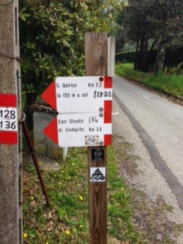
Passing through Piazza Napoleone in Lucca, you exit the gate San Pietro and cross the road outside the gates. Walk over the bridge across the railway tracks and take the first left along via Nottolini. Passing the train station, the road curves right slightly and you continue on via Tempietto. Alongside the 12m high archways is a dirt path that follows the full length of the aqueduct and leads to the Temple of Guamo which was the original domed tank. Walking along the path I'm initially a little disappointed. The high walls of the acqueduct are certainly amazing and beautiful but the surrounds are somewhat suburban at first. I cross over the busy highway on a metallic bridge and cross two other minor roads along the way. However, I must say that the further you walk the more beautiful the surroundings become. Soon, I have a smile stretched across my face that I simply can't wipe off. Houses are replaced by farmland which is again replaced by gorgeous country side then lush mountainous forest. The horizon is an amphitheater of Appinine and Alpuan mountains and the fields are overflowing with wild flowers of Spring.The path continues up the mountains to an open monumental parkland called "Alle Parole d'Oro". The parkland has a stream with some man made waterfalls. It's a very pretty and peaceful place where I know I'll visit again with my daughter for a picnic. Continuing up the now more steep CIA path with its red and white markers indicating the route to follow, the 128 path heads further up the mountain through forest dotted with wild holly, pines and a variety of dense trees. A few streams with gently flowing water need to be crossed and the rocky pathway is easily navigated. The path is also popular with mountain bikers so you are best to keep to the side of the path as they can hurtle down the path at a very fast pace. Reaching the top of the mountain you exit at an asphalt road but if you walk along about 50m to your right there is a lookout point that proves a wonderful view back across to Lucca and also provides a Birdseye view of the aqueduct. The return walk is mostly downhill then on the flats so it's an easy finish. The entire walk takes around 3.5 hours (about 15km) and makes you appreciate the gorgeous surroundings beyond the walls of Lucca.


No comments:
Post a Comment